Plans for 130 Kingswood homes ‘absolute disgrace’ as nearly 700 objectors speak
3 April 2026
Plans to build up to 130 homes on protected green belt land between Kingswood and Burgh Heath have sparked a fierce backlash, with nearly 700 objections lodged by residents.
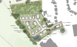
Developers want outline planning permission for the scheme on 13 hectares of farmland off Canons Lane, with details like layout and design to be decided later. The proposal includes a mix of homes, nearly half classed as “affordable”, alongside green space, play areas, allotments and a community orchard.
Lightwood, the developers, state the land presents a “opportunity to create a high-quality, thoughtfully designed place to live, work and connect with nature”.
But the scale and location of the development have become the biggest flashpoints. The site sits in the Metropolitan Green Belt and an Area of Great Landscape Value, currently made up of open fields used for farming. It also borders existing homes and is criss-crossed by public footpaths used by walkers and cyclists.
Residents say building here would mean sacrificing one of the last stretches of countryside before Greater London.
One objector called the plans “an absolute disgrace”, warning they would “start the loss of the last remaining parcels of farming land” and harm wildlife. Others pointed to records of protected and declining bird species on the land, arguing the development would fragment habitats and disrupt migration routes.
Traffic is another major concern. Access would come from Canons Lane, with opponents saying the rural road is not fit for the extra cars likely to come with 130 households. Nearby routes, including the busy A217, are already under pressure at peak times.
There are also doubts about whether the scheme would genuinely tackle the housing crisis. Some residents argue that so-called affordable homes (typically priced below market rates rather than at social rent) would still be out of reach for many.
Despite this, developers say the site is in a sustainable location, within walking or cycling distance of schools, shops and transport links, including Kingswood railway station. They argue it would form a logical extension to the existing built-up area and deliver much-needed housing.
The plans also promise environmental measures, including new tree planting, upgraded footpaths, and sustainable drainage systems designed to reduce flood risk.
In planning terms, the application is only seeking approval ‘in principle’, with all detailed design matters reserved for a later stage except for the main access point.
Supporters say the benefits, particularly new homes and affordable housing, should carry significant weight. But with objections outnumbering supporters almost 175 to one, the council faces a contentious decision over whether those benefits outweigh the loss of protected countryside.
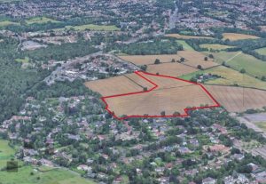
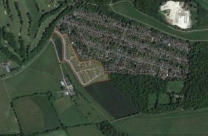
View of the outline of the proposed development site between Canons Lane and Doric Drive, Kingswood. (Credit: Lightwood planning documents)
Caterham will try to force a rental of long empty Post Office
3 April 2026
A long-empty post office building in the heart of Caterham could finally be brought back into use under new council powers despite concerns over cost, risk and whether it will work.
Tandridge District councillors approved plans on March 26 to use a Government-backed High Street Rental Auction to force the former Station Avenue site to be let after years of vacancy in a prominent town centre location.
Members said the building has become a “significant eyesore” and a source of frustration for residents and businesses. Cllr Rob Spencer said: “You come to Caterham and you’re looking at a dead, old building,” adding the council had reached “the end of our tether” waiting for it to be occupied.
How the scheme works
Under the scheme, the council can designate the town centre for a High Street Rental Auction and formally notify the landlord. If the owner fails to secure a tenant, the council can step in to market and auction the lease, with a tenant potentially in place within around six months.
If successful, the move could bring the building back into use, boosting footfall and improving the high street.
However, officers warned the situation is complex. The property has multiple owners, and high asking rents and sale prices have deterred interest so far. They added it is still possible no suitable offers will come forward, even through an auction process.
Concerns over cost
The project is expected to cost around £15,000, with some money potentially recovered through grants and fees. Officers also noted the council cannot guarantee it will recover costs, with much of the expense tied up in staff time.
However, councillors raised concerns about where the funding would come from. Cllr Jeremy Pursehouse said: “It does sound like we’re rummaging down the side of the sofa.”
Mixed views from councillors
Opinion among members was divided. Cllr Mike Crane backed the proposal, calling it “a no-brainer” and suggesting the committee was “over-thinking” the issue.
But Cllr Perry Chotai warned the move could “set a precedent” and criticised the lack of detailed analysis. “This sounds a bit like a Trumpian style of analysis,” he said, calling for clearer evidence on risks and outcomes.
Despite reservations, councillors agreed to press ahead, viewing the auction as a potential way to revive the town centre even if success is not guaranteed and public money may be at risk.
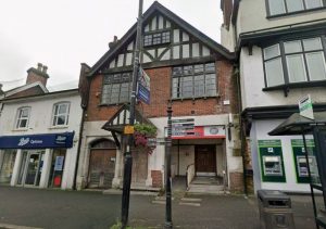
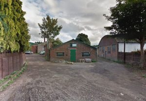
Former Caterham post office. (Credit: Google street view)
Oxshott Uproar as 800 Object to Green Belt Housing Plan
3 April 2026
More than 800 objections later, a controversial plan for 250 new homes on green belt land in Oxshott is set to be decided by a planning committee, and the recommendation is for approval.
Amidst traffic concerns, infrastructure worries and wanting to protect the green belt, councillors must decide if this huge village expansion in Oxshott is to go ahead.
Elmbridge Borough Council’s planning committee will consider the outline application for Clouds Hill Farm on Wednesday, March 25.
The proposal would see existing buildings on the 23-hectare site demolished to make way for a new housing estate, along with roads, parking, public open space and a “suitable alternative natural greenspace” (SANG).
At this stage, only the access points from Leatherhead Road and Woodlands Lane are being decided, with details like layout, design and landscaping to come later if permission is granted. The homes are expected to be two to three storeys high.
Planning officers have recommended approval, arguing that, on balance, the benefits outweigh the harm.
They say the scheme would help deliver new housing, including affordable homes, and could meet national planning rules for building on so-called “grey belt” land. Surrey County Council highways officers have also raised no objection, subject to improvements.
But the application has sparked a major backlash locally. More than 800 letters of objection from over 600 households have been submitted, citing worries about traffic, safety and pressure on local services.
Residents say the area’s roads are already congested and fear an extra 250 homes would make things worse, particularly along the busy Leatherhead Road.
Others argue that the village lacks the infrastructure of schools, GP surgeries and public transport to support a development of this size.
Environmental concerns have also been raised heavily. Objectors warn the plans would mean the loss of Green Belt land, wildlife habitats and trees, and question whether the development can genuinely deliver the required biodiversity net gain. Some have also flagged flood risk and drainage issues.
Campaign groups and residents’ associations have gone further, claiming the site is not in a sustainable location and that the project could permanently change the character of the area.
People claim there is not much public transport in the area so there will be a heavy reliance on on cars, making the quiet Surrey village busier.
Support for the scheme has been far more limited, with a small number of submissions pointing to the need for more housing and potential improvements to walking and cycling routes.
If councillors agree with officers, outline permission will be granted, but only if the developer signs a legal agreement to secure key contributions, including affordable housing, environmental mitigation and transport measures.
If that deal is not finalised within six months, the application could still be refused.
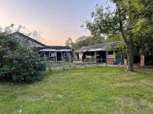
Photo: Stables and outbuildings at Clouds Hill Farm, Oxshott. (Credit: Fairmile Group Ltd./Elmbridge Borough Council planning documents).
.
.
.
Three beers for Dorking
3 April 2026
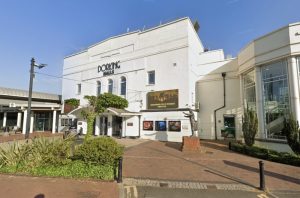
Beer fans will be pumped to know that Dorking Halls will be able to offer customers a greater variety of booze after planning permission was secured to convert storage units into cellars. Antique hunters may be less than thrilled however. Mole Valley District Council has given itself the green light to convert the units at the northwest of the halls so they can be used by the town’s flagship theatre. The block had been in long-term use by Dorking auctioneers P F Windibank to keep its wares and will force the company, which been based there for over half a century, to move elsewhere. Officers, who recommended the conversion be approved, said it would support the “popular leisure and cultural facility”, Dorking Halls, and help its long-term viability.
They told the March development management committee: “They consider they need more (space), to provide a greater variety of drinks and they need more storage for beer kegs. The proposed change of use would support Dorking Halls and the wider town centre economy. Dorking Halls is an important venue for Mole Valley, it provides opportunities for leisure and recreation both for those living within and outside the district.”
John Collins, speaking on behalf of the application, said the increased storage was needed due to the scale of activities and that revenues generated through bar sales underpinned the venue’s viability. He said the Dorking Halls was cherished by the community and added: “The current cellarage was simply not adequate and more space needed to improve back of house operations and comfort within the facility. Being able to have a comfortable welcoming place with a decent bar is all part of that experience.”
Councillors at the meeting expressed concern over how it would impact the town’s antique scene – although that lies outside the committee’s remit. Cllr Claire Malcomson (Liberal Democrat: Holmwoods and Beare Green) said: “I know Dorking Halls is an extremely precious asset that we have but I do also think this is going to (impact) some of the trade in Dorking. So I am not going to pass judgement or anything but I wanted to make that comment because I think this could be quite a loss for us.” Cllr Kirstie Havard (Liberal Democrat: Capel, Leigh, Newdigate and Charlwood) added: “This application is causing great harm to that business they have been there for 80 years. It’s arisen after the first phase of Dorking Halls (refurbishment) was completed and it was decided that space was needed, and I understand the reasons, but I’m very worried about Windibank and what they are losing, and it is very harmful to their business.”
Epsom and Ewell Local Plan tensions surface as committee debate curtailed by chair
3 April 2026
A meeting of Epsom and Ewell Borough Council’s Licensing and Planning Policy Committee (LPPC) on 10th March exposed growing tensions over the borough’s Local Plan after councillors attempted to debate how revised evidence is being submitted to the Government’s Planning Inspector.
The committee ultimately voted seven in favour with two abstentions simply to “note” the Local Plan update report, with the chair not voting.
But the discussion revealed frustration among some councillors over the level of member oversight of changes being made during the examination process.
Inspector requires further work on Local Plan
The meeting began with a detailed briefing from the council’s Head of Planning Policy explaining that the Local Plan, submitted for examination in March 2025, had been judged“unsound”by the Planning Inspector and required further work before it could proceed.
He told councillors that the Inspector had requested additional technical work to determine whether modifications could make the plan sound.
Two pieces of revised evidence had already been submitted earlier this year:
• a revised section of the Green Belt Topic Paper • an updated Land Availability Assessment
Further work has now been requested, including the preparation of potential additional site allocations and updates to the housing trajectory, sustainability appraisal, habitats regulations assessment, transport assessment and infrastructure delivery plan.
All of this work must be submitted to the Inspector by 10th April 2026.
Officers warned councillors that national policy now discourages long pauses in Local Plan examinations and that delays could risk the plan being withdrawn.
Debate centres on councillor oversight
Much of the discussion that followed focused not on housing sites themselves but on whether councillors had sufficient opportunity to scrutinise documents being submitted to the Inspector.
Independent councillor Alex Coley, who had requested the agenda item, raised concerns about the process and argued that wider oversight of the evidence base was necessary.
He told the committee that effective decision-making required proper evaluation of alternatives and meaningful access for councillors and the public to the decision-making process.
Coley also suggested that some of the conclusions contained in recently submitted evidence appeared contradictory and said this demonstrated the need for greater scrutiny.
“I believe that sets out just one example of why wider public oversight is so important,” he said.
Chair maintains procedural limits
However, councillors were advised that the committee could not introduce procedural motions or amendments relating to the Local Plan submissions.
Coley told the meeting that members had received advice from the council’s Monitoring Officer stating that motions from the floor were not permitted under the committee’s procedures.
He questioned that interpretation, suggesting it relied on provisions from an older model constitution that the council had replaced in 2023.
Despite this, the chair, Councillor Peter O’Donovan (RA, Ewell Court), maintained the procedural position and the meeting proceeded without amendments to the report or further debate on altering the process.
The committee therefore confined itself to noting the update report.
Questions raised about future scrutiny
Councillors also asked whether the committee would have further opportunities to review documents before they are submitted to the Inspector.
Officers said the timetable made that unlikely for the next stage of work.
“With the deadline for the evidence base being the 10th of April… there isn’t time for a committee to do that,” councillors were told.
Instead, public consultation on the new material will take place later in the examination process once the evidence has been submitted.
Campaign concerns continue
Outside the council chamber, the Local Plan debate continues to attract strong public interest, particularly over potential Green Belt development.
Campaign group Epsom Green Belt circulated a message to councillors following the meeting expressing concern that revised Local Plan documents could be progressing without full scrutiny by elected members.
The group urged councillors to ensure that any material changes affecting Green Belt land are properly reviewed and debated.
Next steps for the Local Plan
The Local Plan examination will now move into its next stage.
Key steps expected include submission of new evidence to the Inspector by 10 April 2026, followed by consultation on the new documents and potentially further examination hearings.
If the Inspector concludes that the plan can be made sound with modifications, the final decision will return to Full Council, where councillors will vote on whether to adopt the revised Local Plan.
“The Council submitted the Local Plan on the 10th March 2025 for independent Examination.
The Examination process is led by the Planning Inspector who is tasked with examining the Local Plan on behalf of the Secretary of State to determine whether the local plan is sound and legally compliant.
During the Local Plan Examination Hearings, the Inspector requested that the council undertake two discrete pieces of work that required revisiting and updating specific sections of two documents that form part of the Submission Library.
One of these pieces of work was updating Section 4 of the Green Belt Topic Paper in accordance with a revised methodology agreed with the Inspector during the examination hearings. This work was completed and submitted to the Inspector by the agreed deadline under delegated authority.
The Council’s letter to the Inspector dated 11th February 2026 makes it clear that the updated Section of the Green Belt Topic Paper does not consider other constraints to development or conclude whether the sites are suitable for allocation. However, we state that if this information is required to progress the Examination, then the Council can undertake this work.
The Inspector’s letter dated 12th February 2026 confirms that the above work is necessary for the examination to proceed, and has asked the Council to undertake this work along with updates to specific pieces of evidence, notably:
Housing Trajectory / 5 Year Supply
The Sustainability Appraisal
The Habitats Regulations Assessment
The Infrastructure Delivery Plan
The Transport Assessment
The Council is now undertaking this work.
The Local Plan Programme Officer confirmed on the 3 March 2026 that the evidence detailed above in addition to the two pieces of additional work submitted in January 2026, will be subject to public consultation.
There are no timescales for the public consultation at present and it is anticipated that the Inspector will require an additional Examination Hearing(s) to be held following this public consultation.
It is the Local Plan inspector who makes the final decision on the main modifications to be made to the Local Plan. Prior to the Inspector issuing her binding report, there will be a six week statutory public consultation on the main modifications which the inspector considers necessary to make the Regulation 19 version of the plan sound.
Once that process ends, if the Inspector is happy to confirm that the Plan is indeed ‘sound’ subject to main modifications, all Members will be invited to offer a view and make a decision at Full Council, where they will then be asked to vote on whether to approve the modified Local Plan or not.”
The Council’s explanation makes clear that revisions to the Green Belt Topic Paper were carried out following requests from the Planning Inspector and submitted under delegated authority as part of the examination process. It also emphasises that the updated section does not itself determine whether sites should ultimately be allocated for development.
However, the statement does not directly address the central issue raised by Horton ward Conservative Councillor Kieran Persand — namely whether revised evidence, including document COUD_021 and related material, was submitted without prior scrutiny by the Local Plan Policy Committee or Full Council. The Council’s response focuses on the examination process and future public consultation, but does not explicitly confirm whether councillors were given an opportunity to review the revised evidence before it was sent to the Inspector.
As the Local Plan examination moves forward — with further evidence updates, public consultation and potentially additional hearings expected — the question of how and when elected members are involved in reviewing changes to the evidence base may remain a point of political debate within the borough.
Affordable housing scheme approved on Leatherhead green belt
3 April 2026
Greenbelt land in north Leatherhead will be built on after a 100 per cent affordable housing estate was granted planning permission.
Mole Valley District Council’s development committee approved the proposals despite fears it could open the door to others looking to pick off valued sites. The 47 homes by developer Carmen Corp will be built in Oxshott Road, Leatherhead, next to the Tesco store after officers said the need for affordable housing outweighed damage done to green belt.
The site lies on rundown land near the M25 and its condition raised concerns with those opposed to development who argued it could encourage others to let greenbelt land fall into disuse to ease planning. Those in favour suggested the 47 affordable homes was too good to pass up – particularly as it was surrounded on three sides by development and currently looked like “no-man’s land”.
The plans were passed by seven votes in favour to four against.
Claire Malcomson (Liberal Democrat: Holmwoods and Beare Green) said: “Just because it’s degraded land is not a reason. We welcome affordable houses, we really don’t want people to think we don’t.
“This piece of land has been used badly for flytipping, and yes it would be wonderful if it hadn’t been. But I am concerned about this and I do feel that developers might be sort of almost trying to twist our arms just because it’s affordable.”
Others argued the site, derelict and surrounded on three sides, was exactly what was meant as grey belt. Its location next to a large Tesco store, as well as the affordable housing offer, meant the majority backed the plans.
The developer told the March 4 meeting the site suffered from historic misuse, flytipping and ecological decline – and highlighted the housing shortage in the borough. He also addressed questions on affordable housing, saying extra houses could only be occupied if they were made available at below market rates – such was the basis of Homes England funding.
Cllr Monica Weller (Liberal Democrats: Bookham West) said: “We need to be honest about what this site actually is now. Is this pristine, untouchable countryside or is it more, I hate to say, a wasteland?
“I felt that I was going into no-man’s land. Let’s not joke or kid ourselves that this is special, this is rough. And affordable housing is one of the biggest issues facing families.”
Plans for Oxshott Road near Leatherhead (image MVDC)
Fresh Local Plan row as councillor questions Green Belt revisions and governance at Epsom and Ewell
3 April 2026
Concerns are growing over Epsom and Ewell Borough Council’s Local Plan after campaigners and a borough councillor raised questions about revised evidence submitted to the Government Planning Inspector — including whether key changes were made without councillor oversight.
The controversy centres on documents submitted during the independent examination of the borough’s Local Plan, which will determine where housing development can take place for years to come.
A Green Belt campaign group, a planning expert and Conservative councillor Kieran Persand have all raised concerns about revisions to the evidence base — particularly a Green Belt Topic Paper which could influence whether some land currently protected as Green Belt is opened for development.
Campaigners question governance of revisions
The issue first surfaced in a widely circulated email from the Epsom Greenbelt Group to borough councillors warning of “urgent and serious concerns regarding the recently submitted revised Local Plan documents and the process by which they appear to have been approved and issued.”
Campaigners argue that councillors previously authorised officers only to make minor corrections to documents submitted to the Planning Inspector — not material revisions to the evidence.
They say that if significant changes were submitted without member oversight it would raise serious governance concerns and undermine democratic accountability.
The group has called on councillors to clarify what authority officers relied upon when submitting revised documents and whether the Council’s Monitoring Officer has reviewed the matter.
Expert analysis identifies potential Green Belt changes
Planning expert Tim Murphy has reviewed the Council’s January 2026 Green Belt Topic Paper and identified 33 Green Belt sites assessed for their contribution to preventing urban sprawl and protecting countryside.
Mr Murphy said several sites which scored relatively highly under the Council’s own Green Belt rating system were nevertheless recommended for boundary changes that could allow development.
The sites highlighted include:
Land north of College Road at Downs Farm
Land near Ewell East Station
Land west of Burgh Heath Road near South Hatch Stables
Land extending the Noble Park estate within the Hospital Cluster
Mr Murphy said the justification offered was the existence of “exceptional circumstances”, but added that he did not find the arguments convincing.
He noted that these sites have ratings comparable to Horton Farm and the Hook Road Arena — two locations which generated significant public opposition during Local Plan hearings last year.
Other Green Belt sites treated differently
Mr Murphy also pointed out that other Green Belt locations with similar ratings are not recommended for boundary changes, including:
Hollywood Lodge
Drift Bridge Farm
Land off Banstead Road
Land east of Burgh Heath Road
Several smaller sites near Downs Road
The difference in treatment raises questions about consistency in the assessment process.
Meanwhile, a separate planning application for 110 homes at Langley Vale — on land not recommended for Green Belt boundary change — was recently rejected by councillors by six votes to two.
Councillor calls for urgent review
The debate intensified this week when Horton ward Conservative councillor Kieran Persand wrote to the chair of the Council’s Local Plan Policy Committee (LPPC) urging urgent action.
In his email to councillors, Persand said he had become aware that revised evidence had been sent to the Planning Inspector which “materially differs from evidence previously submitted,” including a document known as COUD_021.
He said the document appeared to have been submitted without review or approval by the LPPC, the committee responsible for overseeing the Local Plan.
Persand wrote that he had already identified “important errors and other concerns” in the document which he believed should have been addressed before submission.
He also said he had been unable to find any significant change in circumstances — such as changes in national policy — that would justify altering the conclusions of the borough’s earlier Green Belt assessment.
Further Green Belt additions possible
Persand warned that the situation may be evolving further.
According to correspondence with the Planning Inspector cited in his email, council officers indicated that additional evidence and amendments could be submitted by 6 March, potentially including recommendations for further Green Belt sites to be added to the Local Plan.
Persand noted that there were no Local Plan Policy Committee or full council meetings scheduled before that date.
“This suggests that the officers’ amendments to submission documents, and proposals for changes to the Local Plan they plan to submit on 6 March, will also not be subject to any review or approval by the LPPC or Full Council,” he wrote.
He warned that proceeding without councillor oversight could expose the council to accusations of failing in its duties and even potential judicial review.
Call for documents to return to councillors
Persand has asked the committee chair to arrange for all evidence documents submitted to the Inspector to be brought before the Local Plan Policy Committee before any further submission.
He acknowledged that doing so could delay the council’s proposed timetable but argued this would be preferable to risking more serious problems later in the process.
Questions to the council remain unanswered
The Epsom and Ewell Times contacted the council’s communications department on 28 February seeking clarification on the situation.
The newspaper asked whether a revised paper recommending the removal of some sites from Green Belt protection had been submitted to the Planning Inspector.
At the time of publication, no response had been received.
What happens next
The Planning Inspector will ultimately decide whether the borough’s Local Plan is “sound” and can proceed.
However, the council itself remains responsible for setting the borough’s strategic direction.
If significant changes to the evidence base are confirmed, councillors may face renewed debate over housing numbers, Green Belt protection and how the Local Plan examination is being managed.
The outcome could shape where thousands of new homes are built in the borough — and whether parts of its Green Belt remain protected — for decades to come.
Ewell’s Looe Set for Flush of New Industrial Investment
3 April 2026
An ageing industrial site in Ewell is set for a major overhaul after councillors backed plans to knock it down and rebuild it with bigger, more modern units.
The scheme at The Looe, off Reigate Road in Nonsuch, will see 17 tired single-storey units demolished and replaced with a new part one, part two-storey building containing nine industrial and business units. Councillors green-lit the plans at an Epsom and Ewell Borough Council planning committee on February 26.
Cllr Phil Neale (RA Cuddington) said: “I think it is going to be a vast improvement. I have had a look at the current site and it’s not one of our most attractive industrial units at the moment.”
There will be fewer units overall (nine instead of 17) but they will be larger, creating more workspace. The total floorspace will jump from 732sqm to just over 1,200sqm.
The new building will mainly cater for industrial and storage businesses. Plans include:
One commercial unit (such as a shop or service business)
Four general industrial units
Four storage and distribution units
16 car parking spaces
18 cycle spaces
Solar panels on the roof
A small security and plant hut
There will also be a new pedestrian refuge crossing on Reigate Road and a segregated footpath along the access road to improve safety for people walking to and from the site.
Planning officers said the land counted as previously developed ‘grey belt’ land, meaning the redevelopment is not considered inappropriate under national planning rules. The developers have also promised a new planting and habitat improvements to the site, over and above the council’s requirement.
Less office space, more industry
The plans will reduce the amount of office space on the site. But council officers said there is enough office capacity elsewhere in the borough, particularly in Epsom town centre and East Street, to absorb the loss. At the same time, the borough has a shortage of industrial and storage space so the new scheme could help meet demand.
Traffic worries raised
Three neighbours objected, raising concerns about large lorries struggling to access the narrow entrance road, vehicles blocking Reigate Road while waiting to enter, sewage capacity and asbestos removal. Concerns about shared boundary walls were deemed a civil matter, and asbestos removal would be handled under separate legislation.
Highways officers said the development would generate slightly more traffic than the current site, but not enough to cause a “severe” impact on the local road network. The new footpath and crossing were described as public benefits.
The Looe, Reigate Road, Ewell. (Credit: Google Street View)
Horses beat cars in Epsom’s Langley Vale housing development application
3 April 2026
Plans to build up to 110 homes on agricultural fields in Epsom have been thrown out with fears of a horse vs car ‘collision corridor’. The Langley Vale scheme has been rejected following fierce objections from councillors, local campaigners, and the Jockey Club.
The proposed site, just a stone’s throw from the world-famous Epsom Downs Racecourse, was described as “unsustainable” and a threat to both local wildlife and the town’s horse racing heritage.
After a heated debate at Epsom and Ewell Borough Council’s planning committee on February 26, councillors shot down the application. Reasons for refusal included the site’s poor transport links, reliance on private cars, harm to the openness of the green belt, risks to horses and riders, and adverse effects on the landscape.
Cllr Jan Mason (RA Ruxley) did not mince her words. “It’s not just a few extra cars,” she said. “Have we actually raised the issue of the Jockey Club? The most famous race in the world is held in Epsom in June and has gone on for probably 300 years. This company is only after money.”
She also highlighted the practical issues for new residents: “If there’s no school nearby, no shops, no bus service, then sticking families up on the downs isn’t giving them a home. It’s dumping them where nothing exists.”
Highways and transport were another huge concern. Cllr Steven McCormick (RA Woodcote and Langley), who represents the area, called the application “fundamentally and legally unsafe,” citing the risk to both residents and the racing industry. “Records reveal a terrifying reality when a horse spooks, its instinct is to bolt for home, often forcing these 500 kg animals onto the public road network” he warned. “By placing 110 homes and hundreds of daily car movements at the mouth of the Warren, a known site for unseated riders, we are creating a collision corridor.”
Local campaigners echoed those concerns. John Mumford, speaking for the Langley Vale Action Group, noted the overwhelming public opposition of 374 letters of objection and a petition with 2,232 signatures. He said: “ For every reason put forward to justify the scheme, there are more compelling policy and environmental reasons as to why this scheme should be refused.”
Bernice Froud (RA Woodcote and Langley), another councillor, painted a vivid picture of the community at risk. “You cannot mitigate the destruction of a community’s soul.” She pointed to horses being part of Epsom’s heritage amongst other wildlife. “The rare and beautiful plant, the night flowering catchfly, has chosen our village as its home. Once we pour concrete over it, we will destroy this site of nature conservation importance forever.”
The Jockey Club added weight to the case, stressing that Epsom’s horse racing industry generates over £63m a year and that the development would “have a significant adverse impact” on operations and equestrian safety, including routes used by racehorses to reach training grounds.
While councillors agreed homes, especially affordable ones, are sorely needed, it does not come at any cost.
Image: View of proposed Langley Vale development. (Credit: Fairfax Aspire Ltd/ Epsom and Ewell Borough Council planning documents)
The Ripley effect of rural development in Surrey
3 April 2026
Surrey villagers say they fear their semi-rural community will be “overwhelmed” by development.
Ripley is frequently named one of the prettiest and best places to live in Surrey. But locals are worried it could soon lose the charming character that drew them there as plans for up to 540 homes on farmland edge closer to submission.
The proposed development of Grove Heath North, between Ripley and Send, would see hundreds of two- and three-storey houses built on farmland off Portsmouth Road. While the scheme is still at the environmental scoping stage, locals say the scale alone is enough to change the face of the historic village for good.
‘Completely out of character’
Brian Crosby, chairman of the Grove Heath North Residents’ Association, moved to Ripley 33 years ago from Twickenham for what he calls its “semi-rural character”.
Brian said: “We want to maintain the identity of villages at the edge of the countryside. This [development] just doesn’t sit comfortably behind the existing houses. It would virtually join Ripley to Send Marsh creating more urban sprawl.”
He described the proposal as a major speculative development that is not currently identified as a potential development site in the Local Plan and is a complete shock to our residents who are in disbelief, adding: “The developers do not care what happens to the village afterwards.”
To add insult to injury, the scheme also borrows the very name of Brian’s road, Grove Heath North, which is almost opposite the site. He said he has raised the issue with the developer, arguing it will be confusing for emergency vehicles or delivery drivers in future.
Residents are particularly concerned about three-storey homes, which they say would be “completely out of character” in a village proud of its heritage and historic High Street, once known as the first stop on the coaching route to Portsmouth from the 16th century. The Allium Park Development a mile up the road has 3 storey building being built and these are completely out of character.
While Brian accepts more homes are needed, he argues they should not be built on greenbelt farmland. “This is the easy option,” he said. “The land is used for agriculture. Don’t we need more farmers and people producing food for our country?”
Plans include a new village green, a nature trail and suggests a new local shop. However, the application does not clarify if the developers would build it and the new store would be located next to an existing farm shop.
But Brian said it felt like it was part of a tick-box exercise. “Ripley has one of the largest village greens in the country,” he said. “Giving us effectively what we have already got isn’t adding anything. Sally added the proposed site already had public right of way footpaths running across it.
The developer response
A Green Kite Homes spokesperson said: “This site presents an opportunity to deliver a landscape-led development of new homes and community uses in a highly sustainable location. Our proposals would address identified local housing needs, delivering homes in a range of sizes and tenures.
“We have also listened carefully to feedback received during the public consultation and, as a result, have decided to change the name previously used for the site. We will be engaging further with the local parish councils on this.”
Fears over traffic, schools and sewage
Brian and fellow resident Sally pointed to other large schemes in the wider area, including Wisley Airfield (around 2,000 homes), Gosden Hill (1800 homes), Send Marsh (140 homes) and Allium Park (around 620). They argued there is no “joined-up thinking” about the cumulative impact on roads, schools, doctors and drainage.
Sewage capacity has sparked particular anger. Brian claimed the local works are already struggling and have discharged into the River Wey during heavy rainfall in the last few weeks. They pointed to comments from Thames Water indicating major upgrades are not due to be completed until 2030 and Ripley Sewage plant would not be able to meet Government targets for storm overflows until 2045-2050, and questions whether new homes should be occupied before then.
They questioned the pressure on already stretched services. Brian and Sally warned there is only one GP surgery in neighbouring Send which serves both Ripley and Send and one private dentist in Ripley. “The surgery has already had to increase patient numbers and cannot physically increase further,” they said. “Where are all these people going to go?”
There are also claims the local primary school is oversubscribed and there are no local secondary schools nearby, and fears that hundreds of additional commuters would pile a “burden of traffic”. They said roads are already busy, with effectively one main route running through the village, which is often used as a cut-through despite the A3 bypass since there aren’t on and off connections to the A3 at each end of the village.”
A Green Kite Homes spokesperson said: “As part of the planning process, we will continue to work closely with the council and statutory consultees to ensure that local infrastructure can appropriately support development of this scale. This will also include financial contributions towards infrastructure upgrades as part of any future planning consent for the site.”
The current submission is only about setting the scope of environmental studies, not approving the homes themselves. Guildford Borough Council’s decision on the EIA will determine what issues must be examined in detail before any full planning application is considered.
Stoneleigh & Auriol Voters Back Neighbourhood Plan – But What Will It Change?
3 April 2026
Residents of Stoneleigh and Auriol have decisively backed their Neighbourhood Plan in a local referendum, giving it formal authority to influence planning decisions in the area until 2039.
At the poll held on 12 February 2026, 1,296 voters supported the plan, with 92 voting against. Turnout was 20.7% of the 6,724 electorate, with just one ballot paper rejected.
Voters were asked whether Epsom & Ewell Borough Council should use the Neighbourhood Plan to help decide planning applications in the neighbourhood area.
The Council has confirmed that the next step is for the Licensing and Planning Policy Committee formally to “make” (adopt) the plan, after which its policies will be used in determining planning applications in Stoneleigh and Auriol.
What the Plan Covers
The Stoneleigh and Auriol Neighbourhood Plan (SANP) covers around 180 hectares broadly aligned with the two wards and runs to 2039.
Prepared by the Stoneleigh and Auriol Neighbourhood Forum, the plan’s stated vision is to retain the area’s “unique character and strong sense of community” while allowing it to grow to meet future needs.
Once made, it becomes part of the statutory development plan and must be used in deciding planning applications, alongside the Borough Local Plan and national planning policy.
Core Principles in the Plan
The plan does not allocate major development sites. Instead, it focuses on design control, protection of character, safeguarding retail and community facilities, environmental sustainability and parking standards.
Housing and design: New development must maintain consistent building lines and complement existing form, massing and roofscapes, reflecting the area’s largely 1930s suburban layout. Development should generally respect the prevailing two to three storey character, using materials sympathetic to the area. Backland development may be permitted only where access, amenity space and privacy standards are satisfied. The Forum supports higher-density development where it is demonstrably sympathetic and does not harm local character.
Retail and community facilities: Proposals that enhance local retail facilities will be supported, while changes of use that threaten the predominance of commercial uses in retail centres will be resisted.
Green spaces and environment: The plan designates and protects local green spaces, seeks to minimise flood risk and supports renewable energy and energy efficiency measures where compatible with local character.
Transport and parking: Development must assess transport impact and provide adequate residential parking and cycle storage.
What Is Its Legal Weight?
Neighbourhood Plans derive their authority from national planning legislation. Once formally “made”, they form part of the statutory development plan.
Planning applications must be determined in accordance with the development plan unless material considerations indicate otherwise. In practical terms, SANP policies will therefore carry weight in planning decisions and appeals.
However, they must be in general conformity with strategic policies in the Borough’s Local Plan and with national planning policy. They cannot override housing targets or contradict higher-level planning frameworks.
Does It Add Anything New?
The referendum result gives the plan a strong democratic mandate. Yet a legitimate question arises: does the Neighbourhood Plan introduce new planning principles, or does it largely restate existing ones?
Many of its core themes — protecting local character, limiting excessive height, maintaining building lines, safeguarding retail centres, supporting sustainable drainage and requiring parking provision — are already embedded in the National Planning Policy Framework, existing Borough Core Strategy and Development Management Policies, and established appeal decisions emphasising design quality and character.
The plan does not set housing numbers, allocate strategic sites or alter Borough-wide growth targets.
Its practical effect may therefore be less about introducing new rules and more about giving locally specific design guidance additional statutory status, strengthening the weight attached to character arguments at appeal, and sending a clear political signal about community expectations.
Whether that materially alters planning outcomes will be tested in future applications and appeals.
What Happens After April 2027?
The abolition of Epsom & Ewell Borough Council in April 2027 and its confirmed replacement by the East Surrey Unitary Authority will not invalidate the Neighbourhood Plan.
Neighbourhood Plans form part of the statutory development plan for the land area, not merely for the council that adopted them. The East Surrey Unitary Authority will inherit responsibility for applying the SANP in determining planning applications within Stoneleigh and Auriol.
However, the new authority will prepare its own strategic development plan covering a much wider geography. Over time, neighbourhood plan policies can be superseded or carry reduced weight if inconsistent with new strategic frameworks. The Neighbourhood Forum will also require renewed designation if the plan is to be formally reviewed or updated.
In short, the SANP is likely to survive reorganisation — but its long-term influence will depend on how it aligns with the policies of the incoming East Surrey authority.
A Strong ‘Yes’ — and a Test Ahead
With more than 93% of votes cast in favour, residents have clearly expressed a wish to shape development in their area.
The real question now is whether the Neighbourhood Plan will meaningfully change planning outcomes — or whether it primarily codifies principles already embedded in existing local and national policy.
That answer will emerge not at the ballot box, but in the planning committee room — and, potentially, on appeal.