Epsom and Ewell Times
3rd September 2026

ISSN, LDRS and IMPRESS logos

Surrey campaigners seek independent appeal rights over new flight paths

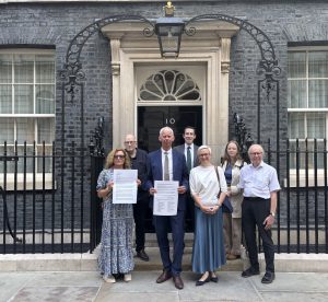
Photo of representatives of the campaign groups at 10 Downing Street.

Surrey countryside campaigners have joined a national call for residents to be given an independent right of appeal when changes are proposed to flight paths over their homes.

CPRE Surrey is among 22 community and environmental organisations that have signed a letter delivered to 10 Downing Street warning that the Government’s aviation reforms could leave the Civil Aviation Authority as both the regulator making decisions on airspace changes and the body answering complaints about those decisions.

The letter, addressed to Prime Minister Andy Burnham, calls for the Civil Aviation (Consumer Protection and Regulatory Reform) Bill to be amended to establish an independent airspace ombudsman.

Campaigners say this would give residents somewhere outside the CAA to seek a review of decisions capable of concentrating aircraft noise over homes, schools and previously quieter areas.

The proposed legislation arrives as the Government begins the most extensive redesign of British airspace for decades. Although the Bill does not itself draw new flight paths or change airport operating hours, it would strengthen the machinery through which approved airspace changes can be implemented.

Its significance for Surrey arises particularly from the planned redesign of the highly congested airspace over London and the South East, involving Heathrow, Gatwick and other airports.

What the Bill would change

The Civil Aviation (Consumer Protection and Regulatory Reform) Bill is a wider aviation measure covering passenger rights, enforcement of consumer law, airport slots, safety regulation and airspace modernisation.

It completed its stages in the House of Lords on 20th July and received its formal first reading in the House of Commons on 1st September. A date for its Commons second reading has yet to be announced.

Under existing legislation, the Transport Secretary can direct an airport, air navigation provider or another organisation involved in airspace change to prepare and progress a proposal. Clause 4 of the new Bill would extend that power so a direction could also require an airspace change already approved by the CAA to be implemented.

The Government’s explanatory notes say this would make the direction-making power available at every stage of the process, including putting an approved design into operation and implementing alterations identified by a subsequent review.

The Government argues that Britain’s underlying airspace design has changed little since the 1950s and is increasingly unsuitable for modern aircraft and present-day traffic levels. It says redesigning routes could permit more direct journeys and improved climb and descent profiles, cutting delays, fuel use and emissions.

The Bill would also allow the CAA to make detailed rules covering aviation safety and operations. However, these general rule-making provisions are distinct from the CAA’s function of deciding individual airspace change proposals. The measure does not expressly abolish consultation on individual proposals or create new flight paths by itself.

A new “guiding mind” for UK airspace

The broader reform centres on the new UK Airspace Design Service, known as UKADS. It is being provided by NATS En Route Ltd, the monopoly provider of en-route air traffic control services.

In its June 2025 announcement, the Government described UKADS as a single “guiding mind” capable of producing a coordinated design instead of relying upon airports to develop overlapping proposals separately.

The Government said UK airspace handled around 200,000 flights annually in the 1950s, compared with 2.47 million in 2024. Without modernisation, it estimated that one flight in five could experience disruption or delay by 2040.

The first priority for UKADS is the London airspace “cluster”. This includes the routes serving Gatwick and Heathrow and would also encompass airspace alterations needed for a third runway at Heathrow.

For Surrey residents, modernisation could therefore determine not merely how many aircraft use the region’s airports but where arriving and departing aircraft fly, at what heights and how noise is distributed.

Modern satellite navigation allows aircraft to follow routes much more accurately. That can reduce the total population affected by noise but may also concentrate flights over a narrower corridor, leaving households directly beneath it exposed more frequently.

How the public is consulted

Individual permanent flight-path changes must normally follow the CAA’s CAP 1616 airspace change process. A proposal is generally sponsored by an airport or air navigation service provider, although UKADS will now take a coordinating role in the London region.

Depending on the scale and likely effects of a proposal, the process includes development of design options, environmental assessment, engagement and public consultation. Consultation responses and other documents are published through the CAA’s Airspace Change Portal.

The portal allows residents to search by postcode or place name for proposals near them. The CAA says CAP 1616 is intended to provide a transparent, impartial and evidence-based assessment taking account of everyone affected.

When making a decision, the CAA must give priority to safety and then consider matters including efficient use of airspace, the needs of aircraft operators, environmental guidance and the interests of people on the ground.

The Government’s revised 2026 air-navigation guidance also sets expectations for engagement and consultation with affected communities and for the assessment of noise and other environmental consequences.

Consultation, however, is not the same as a right of appeal. It allows people to comment before a decision is made but does not necessarily provide an independent tribunal to reconsider the eventual decision.

Existing routes of challenge are limited

Anyone may ask the Transport Secretary to “call in” an airspace proposal and decide it in place of the CAA. But the request must normally be made during a four-week window and satisfy restricted criteria.

According to the CAA’s call-in guidance, a proposal must be of strategic national importance, have a potentially significant effect on UK economic growth, or meet a specified test involving both aircraft noise and its effects on health and quality of life.

The noise test requires a net increase of at least 10,000 people exposed to 54 decibels or more during the relevant 16-hour daytime period. Even if a proposal qualifies, the Secretary of State is not obliged to take it over.

Otherwise, a dissatisfied community may be left to pursue a complaint about whether the proper process was followed or consider judicial review. Judicial review is generally concerned with the lawfulness of a decision, rather than providing a complete reconsideration of whether a different route would have been fairer or less damaging. It can also be costly and procedurally demanding.

The Bill preserves an appeal against a ministerial direction for the person or organisation directed to carry out an airspace change. That is not an equivalent appeal for residents affected on the ground.

It is this gap that CPRE Surrey and the other signatories want an ombudsman to fill.

“Decisions made over their heads”

CPRE Surrey Chair Jennet Eyre said: “This Bill risks giving communities the worst of both worlds: more decisions made over their heads, with no independent way to review them.

“Residents deserve a process that is transparent, accountable and genuinely fair. If there can be independent oversight for passengers, consumers and proposed for the Clean Water Bill then there must also be independent oversight for the communities living under flight paths.”

The campaigners say they are not opposed to airspace modernisation or aviation but believe the interests of the industry should not override the health, sleep and quality of life of affected communities.

Ms Eyre added: “Families on the ground should not be left to live with increased noise, sleep disruption, health impacts or loss of amenity from concentrated flight paths without a clear, independent way to challenge how those decisions are made.”

The Government maintains that modernisation can produce “quicker, quieter and cleaner” flights and says future airspace designs will remain subject to environmental assessment and community engagement.

The central dispute is consequently not whether the public will be consulted at all. It is what residents can do after consultation if they believe their evidence has been disregarded, the effects have been underestimated or the burden of aircraft noise has been distributed unfairly.

CPRE Surrey is now urging MPs to amend the Bill during its Commons stages to provide an independent review mechanism outside the CAA. Whether ministers accept that argument may determine how much confidence communities place in the consultations that accompany the coming redesign of the skies above Surrey.

Sam Jones – Reporter

.

Related reports

Redesigning the Surrey skyways? – 2nd June 2025

Gatwick expansion update – 22nd September 2024

Gatwick Airport Expansion – 2nd March 2024

Gatwick 2nd runway sneaking in? – 20th December 2023

Gatwick expansion plans revealed – 4th August 2023

Gatwick to get 2nd runway? – 13th July 2023


Dirty water double: sewage spills and blocked drains put Epsom and Ewell under pressure

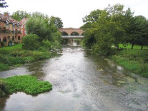
River Mole in Leatherhead - geograph.org.uk Nigel Cox

Epsom and Ewell recorded the longest duration of storm-overflow discharges among seven constituencies examined in a new study of sewage spills across parts of South London and Surrey.

Research undertaken by Purley-based Drainage & Plumbing Ltd using official Environment Agency data identified 55 spills lasting a combined 801 hours during 2025 — equivalent to more than 33 days of continuous discharge.

Almost all the constituency’s total came from the storm overflow at Leatherhead Wastewater Treatment Works, which discharged into the River Mole 49 times for a combined 787 hours. A further four spills, lasting 12 hours, were recorded at the Manor Drive storm tanks discharging into the Hogsmill.

The geographical label refers to the parliamentary constituency in which an overflow is located and should not be confused with the boundaries of Epsom and Ewell Borough Council.

Epsom and Ewell did not have the greatest number of spills in the study. Mitcham and Morden recorded 125 and Reigate and Redhill 61. However, their combined discharge durations were considerably shorter, at 204 and 556 hours respectively.

Across all seven constituencies covered by the research, 250 spills lasting 1,578 hours were recorded during 2025. Epsom and Ewell therefore accounted for just over half of the total discharge time in the study.

The figures came from the Environment Agency’s Event Duration Monitoring returns. These record how often a monitored storm overflow operates and for how long, but not the volume of sewage released.

Storm overflows are intended to act as safety valves when rainwater and wastewater threaten to overwhelm combined sewer systems. They discharge diluted untreated sewage into rivers and other waterways to reduce the risk of sewage backing up into homes. Their frequency and duration have, however, become the subject of growing public and regulatory concern.

Flooding reaches Epsom homes and gardens

The same Drainage & Plumbing Ltd investigation examined Thames Water’s sewer-flooding register for the three financial years from 2022/23 to 2024/25.

Across the Epsom postcode districts, it identified 24 recorded incidents: 12 in KT19, seven in KT18 and five in KT17. Of the 420 incidents identified across all the areas examined, about two-thirds involved external flooding in gardens or yards, while just under one in five reached inside a home or business.

The information was obtained by the company under the Environmental Information Regulations. Thames Water said it did not yet hold a completed register identifying properties formally considered to be at risk of sewer flooding.

The flooding register only covers incidents attributed to Thames Water’s sewer network. It does not include flooding from private drains, burst water mains or surface water which never entered a sewer.

553 highway drainage reports

A separate investigation by the company found that Surrey County Council received 553 reports concerning blocked gullies, blocked highway drains or drainage flooding in Epsom and Ewell during the same three-year period.

Reports increased from 156 in 2022/23 to 229 in 2023/24 before falling to 168 in 2024/25. The latest figure was therefore 7.7 per cent higher than in the first year, although substantially below the intervening peak.

The borough accounted for three per cent of the 18,463 reports recorded across Surrey. Epsom itself generated 288 reports: 70 in 2022/23, 116 the following year and 102 in 2024/25.

The countywide information was obtained from Surrey County Council through a Freedom of Information request submitted by Nima Fazlipour, director of Drainage & Plumbing Ltd. The company said it checked the 18,463 individual records against the Council’s annual and electoral-division summaries.

The figures count reports made by members of the public rather than confirmed blockages. They do not show how many reports concerned the same problem, how many resulted in repair work or how quickly the Council responded. Surrey’s released spreadsheets did not include gully-cleaning totals or dates on which cases were resolved.

A road gully is the grated opening beside a kerb which carries rainwater away from the highway. Its underground pot can become filled with silt, fallen leaves and road debris, leaving water standing on the carriageway after rain.

Highway gullies are generally maintained by the county council, while public sewers are the responsibility of Thames Water. Drains within private property boundaries ordinarily fall to the property owner.

MP says infrastructure is failing

Helen Maguire, Liberal Democrat MP for Epsom and Ewell, has accused Thames Water of failing to invest sufficiently in its ageing infrastructure.

Her intervention came as Thames Water customers remained subject to a hosepipe ban introduced following prolonged dry weather, heatwaves, low rainfall and unusually high demand.

Figures analysed by the House of Commons Library and the Liberal Democrats indicate that Thames Water lost an average of 569.1 million litres of treated water a day through leaks during 2024/25. That is equivalent to approximately 228 Olympic-sized swimming pools every day.

Those leakage figures apply across Thames Water’s network and should not be read as losses occurring within Epsom and Ewell alone. They nevertheless add to concerns about the resilience of the company’s infrastructure as it attempts to manage both periods of drought and the overloading of sewers during heavy rainfall.

Ms Maguire said she had written to Thames Water seeking a meeting about its preparations for increasingly extreme weather and how it intends to make the water network more resilient.

She said: “Thames Water needs to urgently get its house in order. They have got away with their negligent handling of our water infrastructure for far too long. It’s simply not good enough.

“Whilst residents in Epsom and Ewell have to face a hosepipe ban as well as continuing increasing bills, Thames Water continues to fail. Thames Water must stop rewarding their unaccountable bosses with bonuses and start investing in fixing their infrastructure so we can avoid this happening time after time.”

Ms Maguire also called for customer payments to be reinvested in stopping leaks and preventing sewage discharges, supporting her party’s proposal for water companies to be placed under a mutual ownership model.

The Government has already announced that Ofwat will be abolished and its functions combined with water-related responsibilities currently divided between the Environment Agency, Natural England and the Drinking Water Inspectorate. The existing regulators retain their legal powers until the new regulator is established.

Different drains, common concern

The highway gully, sewage overflow, sewer-flooding and clean-water leakage figures describe different parts of the water and drainage system and should not be treated as one dataset.

Taken together, however, they illustrate the competing pressures placed on local infrastructure: too little available water during prolonged dry weather, leakage from the supply network, road flooding when surface drainage becomes blocked and sewage discharges when combined sewers are overwhelmed.

Drainage & Plumbing Ltd brought its two investigations to the attention of the Epsom and Ewell Times. The company, based in Brighton Road, Purley, provides commercial drainage services across Surrey and South London.

EET acknowledges the public-interest work of Mr Fazlipour and the company in obtaining, checking and publishing the official information.

The full datasets and methodology can be examined in the company’s reports on sewage spills and sewer flooding and blocked highway gullies.

Sam Jones – Reporter

.

Image: River Mole in Leatherhead – geograph.org.uk Nigel Cox


Water shortage risk drives Surrey farm plan for irrigation pond

Wheat stock image (Credit: Pixabay)

An east Surrey farm is seeking permission to build a new irrigation pond, as climate change has made water supply a “major operational risk”.

Reid Manor Farm Limited has put forward a prior notification application to Tandridge District Council for excavation works to install the pond in a field to the west of Lingfield.

The applicant noted that “mixed farming activities” are currently undertaken in the area, with hay production being the largest operation.

“There are a number of other farming activities the business is currently exploring and in the process of setting up to support the farming business,” the planning documents say.

Blackberry harvesting and jam making are expected to be included among these activities, the applicant states.

But they added that the proposals for a new irrigation pond represent a “critical business asset” in the cultivation of aquatic plants.

“While south east England is historically the driest part of the UK, climate change has worsened summer droughts and unpredictable rainfall patterns, making reliable water access a major operational risk,” the documents say.

They add: “A farm irrigation pond allows a farm to capture and store abundant winter rainfall, securing an independent, year-round water supply that protects the crop from summer water restrictions and heat stress.”

The applicant also pointed to a government statement published in its ‘Farming Roadmap 2050’, which states: “The scientific consensus is clear that the UK should expect wilder, stormier weather with significantly increased flooding as well as summer droughts. 

“With 70 per cent of our land currently used for agricultural purposes, it will become increasingly important to hold more water on farmlands to help reduce the impact of flooding downriver and support farmers during drought periods.”

Access to the farm via Brickhouse Lane would not be changed as a result of this development, the documents claim.

They add: “The site currently has no mains water connection, and no water bore holes exist on site meaning the only current water source option is harvesting rainwater.”

James Moules Local Democracy Reporter

Image: Wheat stock image (Credit: Pixabay)


Application to drill for oil in Surrey Hills renewed

Sarah Finch Horse Hill 5 Nov 2021 Redhill climate campaigner Sarah Finch at Horse Hill rally 5 Nov 2021. Credit Denise Laura Baker, cleared for use

A Green Party councillor has called for a “rethink” of oil extraction practices in the south of England after research suggested a possible link between drilling and a series of minor earthquakes in Surrey.

Small tremors between magnitude 1.34 and 3.18 were recorded across 2018 and 2019 in the Newdigate area, within a few miles of an oil drilling site at Horse Hill near Gatwick.

Planning permission is being sought to resume oil extraction at the site after its previous approval was quashed by the Supreme Court in 2024 following a long-running campaign.

The court ruled that downstream greenhouse gas emissions should have been considered in any environmental assessment. Surrey County Council said at the time it believed planning rules had been followed.

A UK Oil and Gas Plc (UKOG) statement from the same year said: “A detailed plan for a safe, full suspension of related operations and activities will be implemented following SCC’s concurrence.”

However, charity Friends of the Earth is calling on Surrey County Council to reject this fresh drilling application after presenting a report by Professor Stuart Haszeldine of the University of Edinburgh highlighting a potential link between oil production and earthquakes.

Professor Haszeldine’s work claims there is a “substantial body of evidence” linking the 2018 to 2019 tremors to oil production at Horse Hill.

A 2025 study by University College London researchers published in Geological Magazine also investigated a possible link, running more than one million simulations to assess any correlation.

Lead author Dr Matthew Fox said: “Our study suggests there is a link between the ground earthquakes and oil extraction at Horse Hill but we cannot rule out that this link is a coincidence.”

Dr Fox added that while more work needs to be done to establish if there is a cause and effect, their findings suggest it is “plausible” that oil extraction was behind the tremors.

A UKOG spokesperson previously said British Geological Survey experts “were satisfied it was a natural event associated with movement on a deeper, unassociated fault many miles deeper and distant from the site”.

But Surrey County Councillor Jonathan Essex (Green Party: Redhill East) told the Local Democracy Reporting Service he thinks Professor Haszeldine’s work should prompt “a rethink in how oil drilling is considered in planning terms in the south of England”.

He wants the definition of fracking to be expanded to include all “unconventional oil extraction”, which would see sites like Horse Hill brought under a government moratorium on the practice.

At present, the effective ban only applies to hydraulic fracturing for shale gas – more commonly known as fracking – due to concerns around related seismic activity.

But other forms of hydraulic fracturing in the conventional extraction of oil and gas, such as acid squeezes, are not covered by the government’s moratorium.

Councillor Essex said: “The definition of fracking must be extended to include all unconventional oil extraction – which would then mean that the likes of Horse Hill and other developments across southern England would fall under the current fracking ban.”

The previous Conservative government halted fracking in England in 2019, and the current Labour government has voiced its intent to permanently ban the practice.

Councillor Essex added: “The only way to increase energy security and reduce energy prices in the UK is to increase renewable energy production and to reduce our overall energy demand, such as by insulating our homes.”

A Surrey County Council spokesperson said: “Any comments or issues raised in response to the application will be considered by officers during the determination process in due course.”

UKOG and its subsidiary Horse Hill Developments Ltd did not respond to the Local Democracy Reporting Service’s requests for comment.

A Department for Energy Security and Net Zero spokesperson said: “We intend to ban fracking for good and make Britain a clean energy superpower, to bring energy security, lower bills, and protect current and future generations.”

James Moules Local Democracy Reporter

.

Related reports:

Surrey environmental group gets global recognition

Up hill struggle to stop oil drilling in Surrey – pays off?

Justice Stops Oil

Future of the Planet in Surrey hands?

The Hills Are Alive With the Sound of Drilling… ?

Surrey MPs oppose each other on drills in the hills

Fractious Court case anticipated

Photo: Sarah Finch Horse Hill 5 Nov 2021 Redhill climate campaigner Sarah Finch at Horse Hill rally 5 Nov 2021. Credit Denise Laura Baker, cleared for use

.

.

.

.

.

.

.

.


New Gatwick wetland aims to reduce flood and drought risks

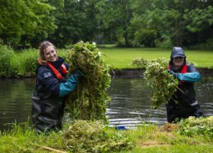
Weed clearing courtesy South-East Rivers Trust

A new wetland capable of holding up to 600,000 litres of water has been created near Gatwick as part of efforts to make the Upper Mole catchment more resilient to flooding, heatwaves and prolonged dry weather.

The South East Rivers Trust has completed the latest phase of a project using natural measures to slow, store and filter water before it travels downstream.

Across two sites, the environmental charity has created the wetland and reconnected 100 metres of river with its natural floodplain.

The wetland will collect rainfall and surface water, releasing it gradually downstream. Restoring the connection between the river and its floodplain will also give water more space to spread out and be held temporarily during periods of heavy rain.

The measures are intended to ease pressure on downstream communities when rainfall is intense, while keeping more water in the landscape during hot and dry periods. The restored areas should also provide new and improved habitats for wildlife.

The work was funded by London Gatwick through its Decade of Change sustainability programme, a strategy covering 10 environmental and social priorities up to 2030.

The latest phase, delivered between July 2025 and June 2026, included:

  • Installing more than 50 “leaky barriers” to slow the movement of water;
  • Planting a 100-metre hedgerow containing 400 native trees;
  • Bringing two more landowners into the catchment project; and
  • Monitoring rainfall, river levels and water clarity to study how water moves through the landscape.

Leaky barriers are carefully positioned structures made from natural materials such as branches and logs. Under normal conditions, water can continue to flow through them, but during heavier rainfall they slow the flow and hold back some of the water temporarily.

George Biggs, project officer at the South East Rivers Trust, said the recent spell of hot and dry weather illustrated one side of the challenge facing the area.

“During the current hot and dry weather, it can be difficult to imagine how quickly heavy rainfall can create problems for our rivers and local communities,” he said.

“The Upper Mole responds very rapidly when it rains, with water moving quickly through the catchment. By restoring wetlands, reconnecting rivers with their floodplains and installing leaky barriers, we can give that water more space and more time.

“These measures help create a healthier, more resilient landscape that is better prepared for both very wet and very dry conditions. They also provide valuable new habitats for wildlife.”

The Upper Mole is particularly responsive to rainfall because of its clay soils, modified river channels and surrounding urban development. Heavy rain can move rapidly downstream, increasing the risk of flooding and placing additional pressure on water quality and river habitats.

Natural flood management seeks to tackle those problems nearer their source by working with the landscape to slow, store and filter water.

Mark Edwards, head of sustainability at London Gatwick, said: “This important initiative, delivered in partnership with the South East Rivers Trust, is a vital part of London Gatwick’s Decade of Change sustainability programme.

“This partnership is a great example of bringing together technical expertise, landowners and local knowledge to deliver practical measures that support biodiversity, water quality and climate resilience.

“It demonstrates how London Gatwick can support enhancements to the local area outside the airport.”

Further restoration work is now being planned across the Upper Mole catchment. Proposals include restoring an old pond so that it can store more water and support biodiversity, installing additional leaky barriers and designing another wetland to improve water quality and availability.

The partners also intend to extend the project into another of the Upper Mole’s six waterbodies, continue monitoring the measures already installed and hold community engagement days about the river and natural flood management.

The project initially concentrated on the headwaters of the River Mole, including Baldhorns Brook near Rusper. Its longer-term ambition is to expand throughout the Upper Mole catchment and demonstrate how nature-based measures could help restore other urban river headwaters across the South East.

Monitoring equipment is recording rainfall, river levels and turbidity – a measurement related to water clarity – so that the Trust can assess how the catchment and the completed interventions respond to wet weather.

Further information about the Gatwick Airport Natural Flood Management Project is available from the South East Rivers Trust.

Sam Jones – Reporter

.

Photo: Weed clearing – courtesy South-East Rivers Trust


Free bus travel for children across England this August

Children outside a bus with thumbs up

Children aged five to 15 in England will be able to travel free on local buses throughout August as part of a Government summer cost-of-living support package.

The free travel offer will run from 1 August to 31 August and is intended to help families reduce the cost of summer holiday journeys to parks, museums, beaches, cinemas, theatres and other attractions.

The Department for Transport says the scheme will apply to local bus services in England. Families are already able to benefit from free travel for children under five across the main bus operators.

Roads Minister Simon Lightwood visited Bath on Thursday 9 July to meet local leaders and bus companies ahead of the scheme’s launch.

The measure forms part of the Government’s “Great British Summer Savings” scheme, which also includes temporary reductions aimed at cutting the cost of children’s meals, cinema and theatre tickets, and admission to family attractions such as theme parks, adventure centres and soft play venues.

Transport Secretary Heidi Alexander said:

“Great British Summer Savings means more people can be excited about getting out and about this summer, whether it’s seeing the Roman Baths, learning something new at the Science Museum, or falling asleep on the bus ride home after a day riding rollercoasters at Alton Towers.

“I know that the cost of living is a concern for households across the UK, which is why we’re cutting the cost of the day-to-day, with free bus travel for children this summer and the £3 bus fare cap helping more families make the most of the small plans that make life enjoyable.”

The Government says the free children’s travel offer comes alongside the extension of the £3 bus fare cap until March 2027, and follows the first rail fare freeze in 30 years.

Ministers say they are also investing £3 billion nationally to improve bus services and support local leaders and operators in delivering more reliable services.

Helen Godwin, Mayor of the West of England, said:

“I am so excited that Kids Go Free is back again. We know what a massive impact this has had for families in the West, helping kids explore the best of the West and putting money back in parents’ pockets.

“I am thrilled that the Government has seen how successful our scheme has been, and that Kids Go Free is going national for August. This will give West Country families the chance to explore even further.”

VisitEngland Director Andrew Stokes said:

“It’s fantastic to see free bus travel for children as the summer holidays get underway, supporting families to get out and explore the outstanding attractions and destinations across England in a stress-free and environmentally friendly way.

“Whether enjoying a trip to our stunning seaside destinations, beautiful countryside or our vibrant city attractions, there is so much to discover during the summer across England. I know our tourism and hospitality businesses will be very pleased to see you.”

Editor’s note:

The free bus travel scheme applies to children aged five to 15 in England during August 2026. It should be checked locally whether any particular operator or route is excluded before travel.


Surrey astrophysicists explore ultra-black satellite coating to protect night sky

Two identical bronze casts - one has been coated with Vantablack® 310 (Credit: Surrey NanoSystems)

A satellite coating made from one of the world’s darkest materials could help tackle a growing threat to astronomy, according to new research led by astrophysicists at the University of Surrey.

With as many as 60,000 satellites projected to orbit Earth by 2030, scientists are seeking ways to reduce their brightness in the night sky.

In a new study published in the Monthly Notices of the Royal Astronomical Society, researchers demonstrate how Vantablack® 310 – an ultra-black coating developed by University of Surrey spinout Surrey NanoSystems, which co-authored the paper – could help reduce light pollution from satellites in low Earth orbit.

The growing number of satellites already in orbit has raised concerns among scientists and stargazers. Reflected sunlight from spacecraft can create bright streaks and flares that interfere with telescope observations and large-scale surveys of the night sky.

This can make it more difficult to detect faint objects, including asteroids, distant galaxies and other important astronomical phenomena.

To tackle the problem, the research team measured how Vantablack® 310 reflects light under a range of illumination and viewing conditions. They then used those laboratory measurements to simulate how a coated satellite surface would appear from the ground.

The simulations showed that the coating could make satellite surfaces significantly fainter, bringing their brightness close to the limit recommended by the International Astronomical Union for protecting astronomical observations.

The findings suggest that ultra-black coatings could provide a practical way to reduce the impact of future satellites on astronomy and the night sky.

Astha Chaturvedi, lead author of the study and a postgraduate researcher at the University of Surrey, said: “The night sky is one of humanity’s oldest windows into the universe, but it is becoming increasingly difficult to see things.

“Our results show that relatively simple material choices could make a meaningful difference to how satellites affect astronomical observations without requiring major changes to mission design.”

Vantablack® 310 reflects only around two per cent of incoming light. The small amount of light it does reflect is distributed more diffusely, reducing the bright flashes commonly produced by reflective satellite surfaces.

Dr Noelia Noël, co-author of the study and Senior Lecturer in Astrophysics at the University of Surrey, said: “Space is becoming increasingly crowded, creating challenges not only for astronomers but for everyone who values an unspoilt night sky.

“What is encouraging about this research is that it moves us beyond simply identifying the problem and towards developing practical, evidence-based solutions.

“As an astrophysicist at Surrey, I am particularly proud that a potential solution to this astronomical challenge has emerged from pioneering materials research at our own University. Vantablack® technology grew from work involving my colleague Professor Ravi Silva and was developed and commercialised by Surrey NanoSystems, demonstrating what can be achieved when astrophysics, engineering and industry work together.”

James Whitfield, Applications Scientist at Surrey NanoSystems and co-author of the study, said: “Satellite constellations offer enormous benefits, but their growing brightness presents a challenge for ground-based astronomy.

“Vantablack® 310 combines ultra-black performance across a wide range of viewing angles with the durability needed for low Earth orbit. We are proud to work with the University of Surrey to help protect the night sky while supporting innovation in satellite technology.”

The team is now preparing for an in-orbit demonstration aboard the Jovian-1 CubeSat mission, a student-led satellite programme involving the universities of Surrey, Portsmouth and Southampton.

The demonstration will test both the coating’s performance in the space environment and whether the resulting change in brightness can be measured from the ground.

The wider Light Pollution and Sustainable Space initiative, led by Dr Noël, was named Best Sustainable Project at the University of Surrey’s 2026 Sustainability Awards, recognising its systematic approach to reducing satellite brightness through material design.

The work has also reached the international stage, with lead author Astha Chaturvedi invited to present the research at the United Nations Workshop on Dark and Quiet Skies in Vienna. Dr Noël has also highlighted the wider challenge of satellite light pollution and the need to protect the night sky through her TEDx talk.

Two identical bronze casts – one has been coated with Vantablack® 310 (Credit: Surrey NanoSystems)

Surrey University


Six months of disruption ahead as major gas and traffic works set to hit central Epsom

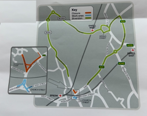
Roadworks and diversion plan SGN

Businesses and residents voice concerns over diversion routes as SGN and Surrey County Council prepare for large-scale works at the East Street/Hook Road/Upper High Street junction

Central Epsom is facing up to six months of roadworks and traffic disruption following the announcement of a major joint gas infrastructure and traffic signal project by Southern Gas Networks (SGN) and Surrey County Council (SCC) Highways.

What’s happening, and when

According to letters sent to residents and businesses this month, the works are being carried out to support new housing development in the area and to maintain the safety and reliability of the local gas network. SGN’s contractor, JDT Utilities, will lay new gas mains in East Street and Hook Road, while SCC replaces the traffic signal system on High Street, Upper High Street and Church Street.

A clarifying email from SGN, seen by this publication, sets out the works in more detail than the resident letters managed to convey. The project will run in two phases:

  • Phase One (planned duration: four weeks) will see SCC install a new urban traffic light system, with new light heads on Church Street, High Street and Upper High Street. Within this footprint, SGN will impose a lane closure — not a full closure — on East Street, to allow open-cut installation of two new mains running from outside The Big Yellow Storage on East Street through to Hook Road.
  • Phase Two will follow, with Hook Road closed between Woodstock Court and East Street while SGN continues its open-cut works down towards the multi-storey car park entrance and Woodstock Court.

The resident letters state that engineering work is scheduled to begin on 18 July, with SCC’s signal works starting on 23 July within the same traffic management setup. Go Epsom, the town’s Business Improvement District, gives a fuller picture of the timeline, stating that works will run from 23 July through to 24 December — a span of roughly five months, and notably longer than the “completed by the end of the year” assurance given in SGN’s own letter.

During the works, the multi-storey car park will remain open and accessible via Hook Road under traffic management, and a signed diversion route will be in place. SGN says access will be maintained for residents and businesses throughout.

Residents question the diversion plan

The announcement has prompted concern from residents about the adequacy of the traffic management plan. One resident, responding to the letter, said the accompanying diversion map was difficult to interpret and that the colour-coding “does not make a lot of sense,” while the flyer gave no indication of where traffic would be diverted to rejoin the A24 on the far side of Epsom, nor any information on bus route changes.

The resident warned that Epsom’s narrow residential streets are already prone to rat-running, and questioned whether roads such as Downs Hill Road and Worple Road — both narrow, and in the case of Worple Road affected by potholes — could safely absorb diverted traffic, including HGVs, without vehicles being forced onto pavements. They suggested a 20mph limit should be considered on any residential road used as part of the diversion, particularly given the number of children walking to and from school in the area.

The resident also raised concern about the six-month duration of the works and its potential impact on trade in Epsom High Street, and said they would be unable to attend either of SGN’s public drop-in sessions this week.

Businesses seek pause over Christmas trading period

Go Epsom has echoed concerns about the scale and length of the disruption. In a message to local businesses, it confirmed the works are expected to run from 23 July to 24 December, warning of “knock on effects with diversions, parking bay suspensions and road closures.” The BID says it is asking SGN and SCC to pause works over the November/December trading period, recognising the importance of the pre-Christmas period to town centre traders.

Businesses affected by the works may be eligible for support through SGN’s small business compensation scheme, details of which are available at sgn.co.uk.

Have your say

SGN is holding two public drop-in sessions this week for residents and businesses to raise questions directly with the engineering team, at the rear offices of 29 East Street:

  • Wednesday 1 July, 4pm–7pm
  • Thursday 2 July, 2pm–4pm

Project updates are expected to be published at sgn.co.uk/our-gas-works/major-planned-projects, and anyone with concerns about disabled access or specific needs during the closures is asked to contact SGN’s customer service team on 0800 912 1700.

Lionel Blackman


Epsom and Ewell Council admit behind hygiene inspections

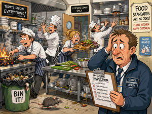
Cartoon busy restaurant kitchen and stressed council hygiene inspector

The borough’s environmental health team has told councillors it is running behind on lower-risk food hygiene inspections — deliberately prioritising higher-risk premises such as takeaways, schools and hospitals over sweet shops and home caterers — as the Environment Committee – Tuesday 30th June – adopted the council’s Food Hygiene Service Plan for 2026/27, in what officers confirmed will be the council’s last year running the service before Surrey-wide local government reorganisation.

Councils have a statutory duty, under a national Framework Agreement on Official Feed and Food Controls overseen by the Food Standards Agency (FSA), to inspect food businesses in their area at intervals set by risk category — broadly, the higher the risk, the more frequent the inspection. As of April 2026, the borough had 611 registered food premises, including 444 restaurants, cafés, canteens and other caterers and 139 retailers. Of these, 133 fall into the higher-risk categories A to C, requiring inspection every six, 12 or 18 months respectively; a further 120 businesses are newly registered and awaiting their first ever inspection.

Catching up, but not quite there

Public Protection Manager Oliver Nelson told the committee the service had actually exceeded its own targets in 2025/26, completing 237 inspections against a planned 161, largely by working through a backlog of overdue inspections and newly registered businesses that had not yet been visited. Even so, the plan for 2026/27 shows 207 scheduled inspections still due — including two Category A premises (the highest-risk tier, inspected every six months), 25 Category B, 77 Category C and 101 lower-risk Category D — plus a further 74 inspections reported as overdue from previous years.

Cllr Steve McCormick (Conservative Woodcote and Langley) pressed officers on why these 74 remained outstanding, and — more pointedly — “why is this statutory service unable to meet this demand, and how can we approve a plan that cannot deliver?” Mr Nelson said the situation was “not unusual” for a local authority environmental health team: the overdue premises are “mainly category E” — meaning very low-risk operations such as sweet shops and small-scale or domestic home caterers — which have been deliberately “deprioritised in favour of food production facilities, schools, hospitals, takeaways” and other higher-risk categories. He explained that his team juggles “four or five different” statutory service areas across several council committees competing for the same limited resources: “It’s a daily task to try and arrange yourself to cover all those bases,” he said, “and what happens is that the lower risk areas are deprioritised in favour of the higher risk every time.”

Staffing pressures and past scrutiny

The report notes that the service has struggled with staff retention, and that a newly created post remains vacant and covered by agency staff — leaving the small team vulnerable, officers said, since even a single experienced officer leaving risks non-compliance with statutory duties. Historically, 1.2 full-time-equivalent officers have been sufficient to meet the Food Law Code of Practice’s requirements for the borough, a level the service says it can currently sustain provided staffing and agency support remain stable.

Cllr McCormick also asked about a reference in the report to “the existing agreed action plan arising from previous Food Standards Agency intervention” — asking what that intervention had covered, and when the service was last formally audited. Mr Nelson could not recall the exact audit date on the night, estimating it was “probably in the last four years,” and agreed to circulate fuller details after the meeting. He said the earlier FSA intervention had flagged underperformance not just in the lowest-risk category but also in Categories B and C, at a time when staff resources had been diverted towards private sector housing casework.

The wider context: a service in its final year

In an unusually reflective note buried in the report’s final section, officers wrote that 2026/27 “will be the final year of delivery of this service by this authority following 90 years of work in the field by Inspectors of Nuisances, Sanitary Inspectors, Public Health Officers and finally Environmental Health Officers” — a reference to the borough council’s abolition under Surrey’s local government reorganisation, with food safety functions due to transfer to a new unitary authority from April 2027.

Elsewhere, Mr Nelson noted that several web links in the appended service plan had broken because the Food Standards Agency had migrated its guidance to the gov.uk website: “If any members of the committee would like those documents, I’m sure Google will be their friend,” he said.

Enforcement activity and the vote

During 2025/26 the service issued four hygiene improvement notices and 200 written warnings to food businesses. No food or environmental samples were taken during the year, officers said, as priority was given to the inspection programme; a separate allocation of around £2,800 a year from the UK Health Security Agency (UKHSA) funds routine microbiological sampling, alongside a local £450 budget for chemical sampling in 2026/27.

The committee voted to adopt the Food Hygiene Service Plan for 2026/27, with one councillor voting against.

Sam Jones – Reporter


Ewell’s Library of Things finally to become a thing?

Bourne Hall Ewell

Epsom and Ewell Borough Council’s Environment Committee – Tuesday 30th June – has agreed to grant a police-approved outdoor storage unit in the grounds of Bourne Hall a five-year lease, with a two-year break clause, after councillors argued that officers’ original proposal of a two-year term was too short to give the volunteer group running the scheme any security.

The store is needed for the borough’s new “Library of Things” (LoT) — a scheme, similar to a book library, that lets residents borrow tools, camping equipment and household appliances rather than buying them outright. It is being set up by the volunteer group Epsom and Ewell Climate Action Network (EECAN) in partnership with Surrey Library Service, and will operate out of Ewell Library at Bourne Hall. Most items can be stored inside the library itself, but larger equipment needs a dedicated outdoor store — hence the need for a legal agreement over council-owned land.

A volunteer’s account

Before councillors debated the report, they heard a three-minute public statement from EECAN volunteer William Ward, describing himself as “a father and grandfather,” who joined the meeting online. Mr Ward told the committee: “I am working with 12 other volunteers to provide this free library of things at Bourne Hall, and I support the recommendations in the report.”

He used his statement to correct what he felt could be misunderstandings in the officers’ report. His original bid to the Community Infrastructure Levy (CIL) — a charge councils can levy on new development to fund local infrastructure — “was for one permanent shed, not multiple units,” he said, and had been approved at a meeting with six borough and county officers on 14 October, when the proposed site was shown to the volunteers present. He set out a lengthy timeline of pre-planning discussions, a planning application submitted on Christmas Eve, planning permission granted on 12 March, and confirmation from Building Control on 19 February that it did not need to be involved.

He also told the committee: “I’ve continued working with all partners, but only became aware last week from reading this report that the borough needed me to consult with the police. I want to reassure the committee that although I am [confident], the design addresses [many] of the risks [identified]. I’m happy to take further advice.” On safety, he noted that insurance was already in place, that Surrey County Council’s principal insurance officer had agreed to cover the store under its “Borrow a Bike” scheme, and that a planned green roof would carry a small solar installation providing only low-voltage lighting, with “no battery charging” to take place inside the unit.

Mr Ward ended with a warning about timing. If the lease “cannot be ready for signing well before April [20]27” — when local government reorganisation is due to sweep away the borough council in favour of a new East Surrey Unitary Authority — he said he might have to ask the incoming authority to reconsider storing the larger items inside Bourne Hall itself. He closed by asking the committee “to also consider the climate risk facing young people today,” saying his aim, with fellow volunteers, “has always been to help residents borrow instead of buy, save money and storage space, while lowering their carbon footprints.”

Officers’ concerns: wrong kind of shed

Introducing the report, Cllr Liz Frost (RA Woodcote and Langley) explained that the store was needed because Bourne Hall library “does not have sufficient storage space for the large items” the scheme requires, and that a two-year, rent-free legal agreement directly with EECAN was proposed, subject to planning permission and a series of health and safety mitigations.

Cllr Rob Geleit (Labour Court) asked officers directly: “Is there a concern that this is a wooden building when it was proposed to be a metal building?” Cllr Frost confirmed this was indeed a live issue. The CIL bid had originally referenced small, “police-approved” metal storage units no larger than 2.2m by 1m by 2m — the kind of secure steel shed used for bike storage. The planning permission that was in fact granted, however, was for a much larger timber outbuilding measuring 7.2m by 3.4m by 3.4m. “There has been… a history of unfortunate incidents with break-ins, vandalism, arson, etc. for buildings like [this],” Cllr Frost told the committee. “So the lease would stipulate a police-approved structure.”

A legal puzzle officers could not resolve on the night

Cllr Steve McCormick (Conservative Woodcote and Langley) raised what he called a contradiction in the report between sections referring to the committee “waiving” the council’s Contract Standing Orders in order to grant the lease directly to EECAN (rather than opening it to competitive tender), and a later section stating that the council would still need to establish the land’s market value to satisfy “best value” — the legal principle requiring councils to secure fair value for public assets. “Forgive me, which is it?” he asked.

No legal officer was present to answer. This was itself the subject of some frustration: Cllr McCormick had earlier asked in the meeting why nobody from the council’s legal team was in attendance, only to be told by an officer that “legal don’t attend committee meetings as standard… there was nothing that was foreseen tonight that would require their attendance.” On the specific question about best value, the officer present said: “I think I would have to take that away and go back to legal on it, because I don’t have the answer for you this evening, I’m afraid.”

The case for a longer lease

The most substantial debate concerned the length of the lease. Cllr McCormick argued strongly for extending it well beyond the two years proposed: “This library of things item is great. We should get it done… I would question the duration, actually, of two years. I think it’s incredibly short,” he said, pointing out that other local charities had recently had leases extended to 15 or 20 years, giving them far more flexibility when applying for grant funding. He initially proposed extending the term to 10 or 15 years.

Officers explained that the two-year figure had come from legal advice, given specifically because EECAN was “a new group” without a track record of running such a scheme; the original suggestion, before that advice, had been five years. Officers said they could see no reason why a review clause could not allow for extension after two years “if all was going well,” but that this would need to be confirmed with the council’s legal team.

Cllr Frost, while sympathetic to the case for grant funding, questioned how much external funding a volunteer-led scheme with no office overheads would actually need, but agreed the recommendation could be amended.

Cllr Julie Morris (Independent College) backed a middle way — five years, with a two-year break clause — and spoke warmly of Mr Ward’s track record: “I’ve known William Ward for some time… he’s not the new kid on the block… he has been involved in environmental and sustainability issues for some years.” She argued that a two-year offer, with an uncertain future council to renew it, sent the wrong message: “I don’t see that as commitment from us to a gentleman that’s actually done quite a lot for this borough that has a very good following, and will undoubtedly make a very good job of it. And I think it should be the role of this committee that we say [to] you’re not here, guys: this is what we want you to do. We want five years with the break clause at two years, because we really want to put our weight behind such a good initiative.”

Cllr McCormick accepted the compromise — “I’d like 10, but five, I’ll go for five” — and, with Cllr Morris seconding, the amendment was carried.

The decision

The committee unanimously agreed, as amended, to enter into a legal agreement at nil rent for five years, with a two-year break clause, for a police-approved outdoor store at Bourne Hall for the Library of Things — subject to the risk mitigations set out in the report — and to delegate the final legal drafting to the Head of Property and Regeneration, the Interim Assistant Head of Service for Venues and Community Commercial Services, and the Chief Legal and Monitoring Officer. Cllr Frost thanked Mr Ward “for coming along and making his presentation to us,” and thanked officers for their work on the report.

Sam Jones – Reporter

.

Related reports:

Epsom “Library of Things” Delayed by Council Stand-Off

Epsom and Ewell Climate Action Network launches with community events and initiatives

The Mayor of Epsom and Ewell meets local climate volunteers


Guildford clean air zone rejected

Park Street Guildford (Credit: Google Maps)

A clean air zone will not be coming to Guildford after councillors accepted a report saying the costs would outweigh the benefits of such a scheme.

Guildford Borough Council’s cabinet was presented with a report into measures to stem the level of harmful air pollution in the town.

The possibility of a clean air zone for Guildford was raised in a draft air quality action plan, although it sparked concerns over its potential economic impact on the town.

Councillor Merel Rehorst-Smith said: “A clean air zone scored highly as a measure capable of delivering air quality improvements within a relatively short timeframe. 

“However, it was recognised that introducing a clean air zone would have significant implications for residents, businesses, and visitors, and therefore a detailed economic feasibility assessment was commissioned before any decision could be made.” 

Clean air zones have become increasingly common in cities and towns across Britain over the past few years, many of which see high-polluting vehicles charged a small fee for entering the area.

However, some schemes opt for traffic control measures instead of charges on motorists.

The London Ultra Low Emission Zone is one of the best known examples, which sees vehicles that do not meet emission standards billed £12.50 to drive within its borders.

A feasibility study into a possible Guildford clean air zone found that such a measure could bring significant costs, and instead recommended targeted interventions in pollution hotspots and incentives for active travel.

It was considered by the council’s overview and scrutiny committee earlier this month, where report lead Dr Margarethe Theseira told councillors: “The reason a clean air zone or low emission zone is not proportionate to local need is that the air quality is very much concentrated on one site, at Park Street. 

“And so it made a broader scheme disproportionate in scale and cost. There are alternative measures you can do to improve air quality at Park Street.”

The research found that Park Street saw especially high levels of pollution as vehicles are forced to drive uphill before being held at traffic lights.

Better traffic management and engineering solutions were floated as options to alleviate nitrogen dioxide spikes in the area rather than a blanket clean air zone for the entire town.

Councillor Rehorst-Smith said: “The study concludes that a clean air zone would not be a proportionate or economically justified intervention for addressing the air quality issues identified. 

“Instead, the study implements a package of targeted measures focused on promoting active and sustainable travel, improving traffic management, and delivering local mitigation measures.”

Guildford Borough Council’s cabinet resolved to note the conclusions and recommendations of the feasibility report.

Councillors also agreed to report its findings to the Department for Environment, Food and Rural Affairs and report back on a revised draft Air Quality Action Plan within six months.

James Moules Local Democracy Reporter

Park Street Guildford (Credit: Google Maps)

.

.

.

.


Link road to Leatherhead recycling centre disruption

North Leatherhead Access Road (image Google)

The critical link road to Leatherhead Recycling Centre is likely to be subjected to weeks of “inevitable” disruption while “long awaited” repairs take place.

It comes as the costs more than double as the details of all the work needed to fix the pothole-filled road, that has seen a spike in the number of insurance claims and complaints, became clear.

The original budget had been just over £300,000, Mole Valley District Council’s June cabinet heard, but that has now leapt to £700,000. 

The road is owned by the district council with third party access rights to Surrey County Council and Thames Water – which Mole Valley expects will help with the costs. 

The county council has already agreed but Thames Water has yet to make its decision.

The project, will widen the road to allow for easier movement, a full resurface, and improved drainage to stop problems with standing water that plague the road.

Councillor Keira Vyvyan-Robinson (Liberal Democrat: Leatherhead North) said: “Everyone who uses the recycling centre will be fully aware of the condition of the road, largely caused by the heavy use by heavy vehicles, but the result is that there are significant potholes, often standing water and the result of that is an increased number of insurance claims and complaints.”

She added: “It’s an investment that I hope residents across Mole Valley will welcome.”

It is likely that any work carried out will be done by Surrey Highways before the end of the financial year. 

It is expected to last for six to eight weeks – with a traffic management plan, understood to be temporary traffic lights in place while it is carried out, once given full council approval.

Cllr Keira Vyvyan-Robinson: “Given the very poor state of the road, given the increasing complaints, the recommendations (which will still need to be approved by council) is to proceed.

“It is inevitable that there will probably be a certain level of disruption.”

Cllr Andrew Matthews (Liberal Democrat: Bookham East and Eastwick) Park said: “It’s been long awaited, it’s going to make the access road up and down to the tip but also for the other users of that road, much safer and easier. ”

Chris Caulfield Local Democracy Reporter

Related reports:

Leatherhead ruined recycling road repair

North Leatherhead Access Road (image Google)