

Stoneleigh & Auriol Voters Back Neighbourhood Plan – But What Will It Change?


Residents of Stoneleigh and Auriol have decisively backed their Neighbourhood Plan in a local referendum, giving it formal authority to influence planning decisions in the area until 2039.
At the poll held on 12 February 2026, 1,296 voters supported the plan, with 92 voting against. Turnout was 20.7% of the 6,724 electorate, with just one ballot paper rejected.
Voters were asked whether Epsom & Ewell Borough Council should use the Neighbourhood Plan to help decide planning applications in the neighbourhood area.
The Council has confirmed that the next step is for the Licensing and Planning Policy Committee formally to “make” (adopt) the plan, after which its policies will be used in determining planning applications in Stoneleigh and Auriol.
What the Plan Covers
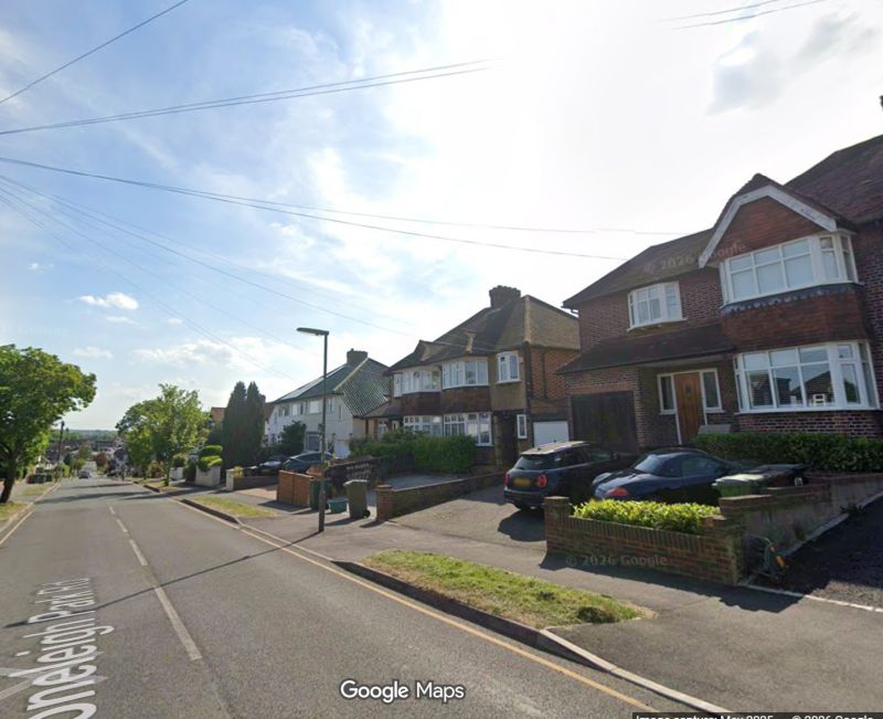
The Stoneleigh and Auriol Neighbourhood Plan (SANP) covers around 180 hectares broadly aligned with the two wards and runs to 2039.
Prepared by the Stoneleigh and Auriol Neighbourhood Forum, the plan’s stated vision is to retain the area’s “unique character and strong sense of community” while allowing it to grow to meet future needs.
Once made, it becomes part of the statutory development plan and must be used in deciding planning applications, alongside the Borough Local Plan and national planning policy.
Core Principles in the Plan
The plan does not allocate major development sites. Instead, it focuses on design control, protection of character, safeguarding retail and community facilities, environmental sustainability and parking standards.
Housing and design: New development must maintain consistent building lines and complement existing form, massing and roofscapes, reflecting the area’s largely 1930s suburban layout. Development should generally respect the prevailing two to three storey character, using materials sympathetic to the area. Backland development may be permitted only where access, amenity space and privacy standards are satisfied. The Forum supports higher-density development where it is demonstrably sympathetic and does not harm local character.
Retail and community facilities: Proposals that enhance local retail facilities will be supported, while changes of use that threaten the predominance of commercial uses in retail centres will be resisted.
Green spaces and environment: The plan designates and protects local green spaces, seeks to minimise flood risk and supports renewable energy and energy efficiency measures where compatible with local character.
Transport and parking: Development must assess transport impact and provide adequate residential parking and cycle storage.
What Is Its Legal Weight?
Neighbourhood Plans derive their authority from national planning legislation. Once formally “made”, they form part of the statutory development plan.
Planning applications must be determined in accordance with the development plan unless material considerations indicate otherwise. In practical terms, SANP policies will therefore carry weight in planning decisions and appeals.
However, they must be in general conformity with strategic policies in the Borough’s Local Plan and with national planning policy. They cannot override housing targets or contradict higher-level planning frameworks.
Does It Add Anything New?
The referendum result gives the plan a strong democratic mandate. Yet a legitimate question arises: does the Neighbourhood Plan introduce new planning principles, or does it largely restate existing ones?
Many of its core themes — protecting local character, limiting excessive height, maintaining building lines, safeguarding retail centres, supporting sustainable drainage and requiring parking provision — are already embedded in the National Planning Policy Framework, existing Borough Core Strategy and Development Management Policies, and established appeal decisions emphasising design quality and character.
The plan does not set housing numbers, allocate strategic sites or alter Borough-wide growth targets.
Its practical effect may therefore be less about introducing new rules and more about giving locally specific design guidance additional statutory status, strengthening the weight attached to character arguments at appeal, and sending a clear political signal about community expectations.
Whether that materially alters planning outcomes will be tested in future applications and appeals.
What Happens After April 2027?
The abolition of Epsom & Ewell Borough Council in April 2027 and its confirmed replacement by the East Surrey Unitary Authority will not invalidate the Neighbourhood Plan.
Neighbourhood Plans form part of the statutory development plan for the land area, not merely for the council that adopted them. The East Surrey Unitary Authority will inherit responsibility for applying the SANP in determining planning applications within Stoneleigh and Auriol.
However, the new authority will prepare its own strategic development plan covering a much wider geography. Over time, neighbourhood plan policies can be superseded or carry reduced weight if inconsistent with new strategic frameworks. The Neighbourhood Forum will also require renewed designation if the plan is to be formally reviewed or updated.
In short, the SANP is likely to survive reorganisation — but its long-term influence will depend on how it aligns with the policies of the incoming East Surrey authority.
A Strong ‘Yes’ — and a Test Ahead
With more than 93% of votes cast in favour, residents have clearly expressed a wish to shape development in their area.
The real question now is whether the Neighbourhood Plan will meaningfully change planning outcomes — or whether it primarily codifies principles already embedded in existing local and national policy.
That answer will emerge not at the ballot box, but in the planning committee room — and, potentially, on appeal.

Related reports:
Epsom & Ewell’s Council responds to Local Plan concerns
Stage 2 Examination of Epsom & Ewell’s Local Plan opens Tuesday
Epsom & Ewell’s Local Plan under the Green microscope
Epsom and Ewell Local Plan Submitted for Examination
Image: Typical Stoneleigh residential road. Google Street View