July find of rare May fly in Surrey
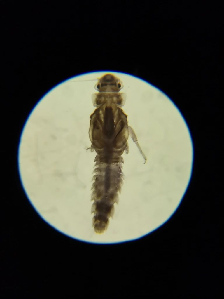
The River Thames Scheme (RTS) has discovered a nationally rare mayfly (Caenis beskidensis), which hadn’t been spotted in the UK for 49 years and has never been seen in the River Thames.
The invertebrate, which was last seen in Herefordshire in 1973, was discovered near Walton Bridge as part of the project’s routine survey work. Historically, they have been found in small and medium-sized streams, but have not been seen since 1973, when last spotted in Herefordshire.
This is an incredibly exciting find for the scheme and demonstrates just how important the survey work that the scheme’s ecologists do is. By establishing the value of the existing habitats living around the Thames the scheme will be able to put plans in place to protect them during the work and help them thrive for the future.
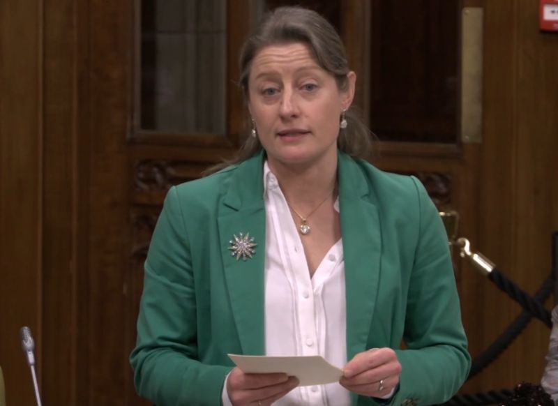
Speaking on the discovery RTS ecologist Jenny Stephenson said: “It is such an exciting discovery to identify something that hasn’t been seen in British water since the 1970’s. Now that we have discovered the Caenis beskidensis in the River Thames we will be able to monitor it and ensure the colony continues to thrive.
“The discovery of the mayfly, which was found in its nymph stage and part of its aquatic life cycle, represents a major expansion in both the distribution and habitat type the species has historically inhabited. We are confident that with the new habitats that the scheme will create we will encourage these may flies to breed further in the future.”

Mayflies form an important part of the river eco-system and are an important food source for fish and, once transformed into its adult form, insectivorous birds. Although the may flies have historically been found in small and medium sized streams they are also found in the upper areas of lowland rivers where they live in slow flowing shallow water. The RTS will create more of these river habitats so the team are hopeful new colonies will thrive.
As part of its work to understand the existing environment the RTS carries out hundreds of ecological and environmental surveys every year. A range of species have been targeted in these surveys, including bats (and their roosts), water voles, breeding birds, great crested newts, fish, invertebrates and species of reptiles.
Hannah Packwood, RTS environmental surveys project manager said: “It’s so important that we understand the existing environment so we can continue to protect and where possible enhance it through the RTS. Finding rare and unexpected species is exciting, and we will continue to monitor the environment in our survey work throughout construction and the operation of the scheme”.
A team of ecologists undertake the surveys by observing, measuring, taking notes and photographs, as well as soil and water samples. These surveys don’t cause any significant disturbance to the environment or to land or property.
The RTS is currently holding a six-week public consultation for people to have their say on plans which includes a new flood channel whilst also providing habitat for wildlife and a new feature in the landscape for recreation. The consultation will run until Tuesday 20 December 2022. Full details of the consultation events, how to get involved, and to discover all venues that have brochures available to pick up please visit the website at www.riverthamesscheme.org.uk or call the Environment Agency National Customer Contact Centre on: 03708 506 506.
- The River Thames Scheme is being delivered in partnership between the Environment Agency and Surrey County Council.
- The scheme’s wider partners are Elmbridge Borough Council, London Borough of Richmond upon Thames, Royal Borough of Kingston upon Thames, Runnymede Borough Council, Spelthorne Borough Council, Thames Regional Flood and Coastal Committee, Thames Water, Enterprise M3 Local Enterprise Partnership, Thames Valley Berkshire Local Enterprise Partnership.
- The River Thames Scheme is an integrated scheme which responds to the challenges of flooding, creating more access to green open spaces and sustainable travel, in addition to encouraging inclusive economic growth, increasing biodiversity and responding to the dual challenges of climate change and nature recovery.
- The project aims to deliver many benefits for local communities and businesses. The new flood channel will reduce the risk of flooding to homes, businesses, and infrastructure, while also providing habitat for wildlife and a new feature in the landscape for recreation.
- The River Thames Scheme will include:
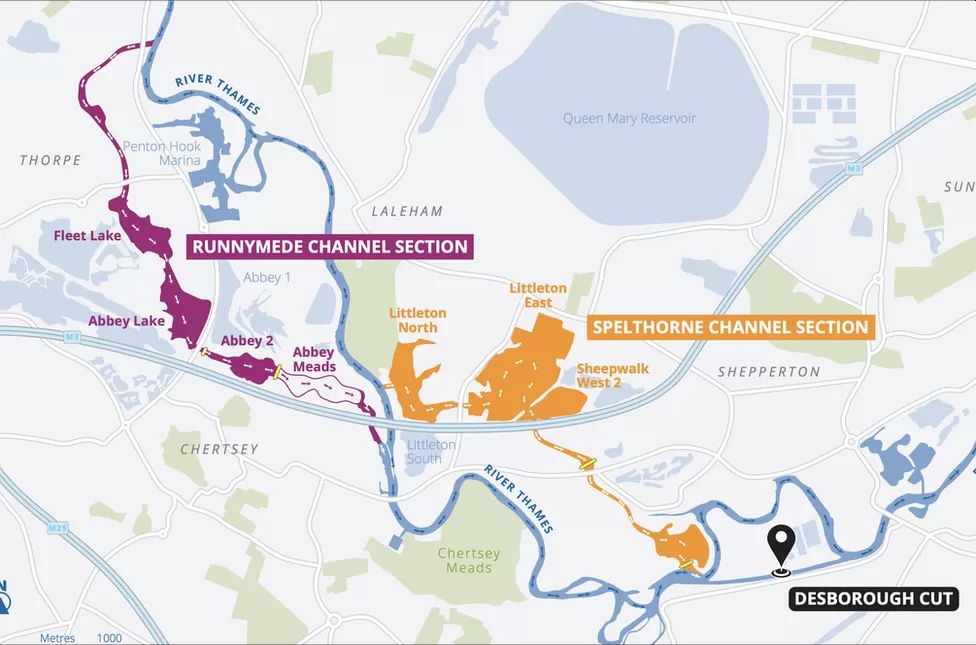
- a new river channel built in two sections – one section through Runnymede (between Egham Hythe and Chertsey) and one through Spelthorne (between Littleton North lake and the Desborough Cut)
- capacity increases around the Desborough Cut and at the weirs at Sunbury, Molesey and Teddington
- improved access to quality green open space and connections with wildlife, in addition to supporting a more sustainable travel network
- a network of high-quality habitat to achieve a biodiversity net gain
- The River Thames Scheme will reduce flood risk to people living and working near the Thames, enhance the resilience of nationally important infrastructure, contribute to a vibrant local economy and maximise the social and environmental value of the river.
- There have been serious floods in this area over the past 100 years, namely in 1947, 1968, 2003 and most recently between 2013/2014.
- The new flood channel will reduce flood risk to over 11,000 properties and 1,600 businesses in Hythe End, Egham, Staines, Chertsey, Shepperton, Weybridge, Sunbury, Molesey, Thames Ditton, Kingston and Teddington.
- There will be increased capacity of the Desborough Cut and weirs at Sunbury, Molesey and Teddington by installing additional weir gates.
- Detailed planning and design are under way. The large scale of the project means the government has directed that it be treated as a project of national Significance. This requires a type of consent known as a ‘development consent order’ (DCO). A DCO removes the need to obtain several separate consents, including planning permission and is designed to be a quicker process than applying for these separately.
Surrey County Council News

